Data Layers
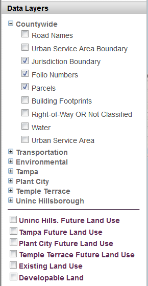
The Data Layers section contains a list of available map layers that can be turned on/off (i.e., displayed on top of the selected Basemap).
- The majority of the map layers are grouped into "Data Sets" (indicated in bold).
- To see the map layers under each Data Set, click the plus sign [+] beside the Data Set name to expand the list.
- To make a map layer visible, click the checkbox beside it.
- The Future Land Use, Existing Land Use and Developable Land are listed separately and not contained in a Data Set.
Tips:
- If a map layer is checked but not visible on the map, you may need to zoom in closer for it to display.
- Turn off any unneeded map layers to speed up loading time.
- Zoom in as close as possible to the area of interest. Less "data" being displayed will speed up loading time.