Main Display
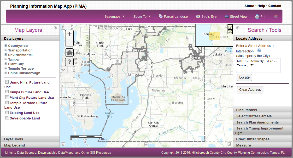
The display window consists of several functional areas described below.
Map Display:
- Displays the map, navigational tools, overview map, and scalebar.
Basic Navigation:
- Click the plus (+) button to zoom in.
- Click the minus (-) button to zoom out.
- Click the 'Home' button to go back to the default Countywide extent.
Mouse Navigation:
- Pan the map by clicking on the map and dragging the mouse cursor in the direction you wish to move.
- If your mouse has a scroll wheel, zoom in/out by scrolling the wheel in the appropriate direction.
- Hold down the Shift key and drag a box on the map to zoom in.
- Hold down Ctrl+Shift to zoom out.
Navigation Arrows (located along the perimeter of the map):
- Pan the map by clicking on the gray arrow pointing in the direction you wish to move to.
Overview Map:
- Minimize/maximize the overview map by clicking on the white arrow in the upper right corner.
- Enlarge/reduce the overview map by clicking on the black arrows.
- Pan the map by dragging the yellow box to the area you wish to move to.
Toolbar:
- Contains tools for common functions.
- See Toolbar for detailed information.
Map Layers (left sidebar):
- Contains tabs related to map layer display and layer-specific functions.
- See Map Layers for detailed information.
Search / Tools (right sidebar):
- Contains task groups for performing search and other functions on the map.
- See Search / Tools for detailed information.
Tips:
- To make the map larger, collapse one or both of the sidebars (Map Layers, Search / Tools) by clicking on the small arrow in the top corner.