Layer Tools
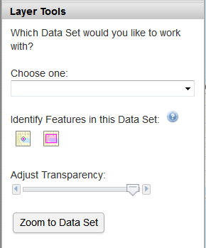
All functions in the Layer Tools section work on the selected "Data Set" as a whole. A Data Set a group of map layers as listed in the Data Layers section. The Future Land Use, Existing Land Use and Developable Land are listed separately and not contained in a Data Set.
Before using any of the Layer Tools, you must choose a Data Set from the dropdown box.
Identify Features in this Data Set
- Click the 'point' or 'rectangle' button.
- Click on a point or draw a rectangle on the map.
- A pop-up window will display the underlying information for each visible map layer that is in the selected Data Set. The information is presented in a feature-by-feature, layer-by-layer manner in the pop-up window.
- Use the arrows at the top of the pop-up window to navigate to each feature.
Sample of pop-up box:
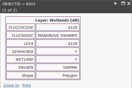
 - Number of features found.
 - Move to the next feature.
 - Maximize pop-up window for easier viewing.
 - Close pop-up window.
"Zoom to" the feature.
"Print" contents of the pop-up window.
To relocate the pop-up window, move the mouse pointer to the header or footer of the pop-up window. Then click and drag the pop-up window to a new location.
Adjust Transparency - Move the "slider" left or right along the bar to make the map layers in the Data Set transparent or opaque. Useful for viewing shaded layers (e.g., land use) on top of the basemap.
Zoom to Data Set - Click the button to zoom the map to the full geographic extent of the Data Set.