Draw/Buffer Shapes
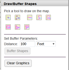
Draw/Buffer Shapes allows you to interactively draw geometric shapes on the map using various "drawing" tools.
Click on one of the tools, then click or "draw" on the map to create the geometric shape.
Once a shape has been drawn on the map, you can create a "buffer" area around the shape. Set the buffer parameters (distance and units), then click the "Create Buffer" button. The "buffer" area will be highlighted on the map.
Click the "Clear Graphics" button to remove the shapes and "buffer" area from the map.
Example Usages:
- Annotate the map.
- Draw preliminary study area boundaries or other areas of interest.