Measure
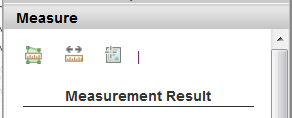
Measure allows for measuring Area, Distance, or Location on the map.
To measure area, click on the "Area" tool and draw a polygon on the map. Double-click the last point in the polygon to end the "sketch". The area (acreage by default) will be displayed under the "Measurement Result". You can display the result in different units by clicking the drop-down arrow beside "Acres" and then choosing another unit.
To measure distance, click on the "Distance" tool and draw a line on the map. Double-click the last point in the line to end the "sketch". The distance (miles by default) will be displayed under the "Measurement Result". You can display the result in different units by clicking the drop-down arrow beside "Miles" and then choosing another unit.
To measure location, click on the "Location" tool and click a point on the map. The location (degrees by default) will be displayed under the "Measurement Result". You can display the result in different units by clicking the drop-down arrow beside "Degrees" and then choosing another unit.
Click the "Clear Graphics" button to remove the drawn shapes from the map.